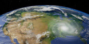
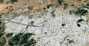
ESRI بەهاوکاری Microsoft بۆ هەموو زەوی Land Coverیان دروستکردووە، کە دەتوانیت بیبینیت و بەکاریشی بهێنیت.
کلیک لەم لینکە بکە بۆ ئەوەی لە شاشەیەکی نوێ سایتەکە بکەیتەوە:
https://www.arcgis.com/apps/mapviewer/index.html?layers=d6642f8a4f6d4685a24ae2dc0c73d4ac
زانیاری دەربارەی پڕۆژەکە:
ئەم پڕۆژەیە بە Mapping AI ،واتە زیرەکی دەستکرد، دروستکراوە، وە نزیکەی یەک ملیار Train داتا پڕۆسێسکراوە.Resolution ی نەخشەکە ١٠م و Accuracy مۆدیلەکە لە 85 بۆ سەرەوەیە، کە زۆر زۆر باشە بۆ هەموو زەوی. وە Sentinel-2 L2A/B بەکارهاتووە لە بۆدروستکردنی Classification ەکە.
جۆری Land Cover کە جیاکراوەنەتەوە بریتین لەمانەی خوارەوە، کە من وەک خۆی دامناوە، چونکە هەندێکیان زانیاری زیاتری نوسیوە کە گرنگە بیزانن کە لە چی پێکهاتووە:
Class definitions
1. Water
Areas where water was predominantly present throughout the year; may not cover areas with sporadic or ephemeral water; contains little to no sparse vegetation, no rock outcrop nor built up features like docks; examples: rivers, ponds, lakes, oceans, flooded salt plains.
2. Trees
Any significant clustering of tall (~15-m or higher) dense vegetation, typically with a closed or dense canopy; examples: wooded vegetation, clusters of dense tall vegetation within savannas, plantations, swamp or mangroves (dense/tall vegetation with ephemeral water or canopy too thick to detect water underneath).
3. Grass
Open areas covered in homogenous grasses with little to no taller vegetation; wild cereals and grasses with no obvious human plotting (i.e., not a plotted field); examples: natural meadows and fields with sparse to no tree cover, open savanna with few to no trees, parks/golf courses/lawns, pastures.
4. Flooded vegetation
Areas of any type of vegetation with obvious intermixing of water throughout a majority of the year; seasonally flooded area that is a mix of grass/shrub/trees/bare ground; examples: flooded mangroves, emergent vegetation, rice paddies and other heavily irrigated and inundated agriculture.
5. Crops
Human planted/plotted cereals, grasses, and crops not at tree height; examples: corn, wheat, soy, fallow plots of structured land.
6. Scrub/shrub
Mix of small clusters of plants or single plants dispersed on a landscape that shows exposed soil or rock; scrub-filled clearings within dense forests that are clearly not taller than trees; examples: moderate to sparse cover of bushes, shrubs and tufts of grass, savannas with very sparse grasses, trees or other plants
7. Built Area
Human made structures; major road and rail networks; large homogenous impervious surfaces including parking structures, office buildings and residential housing; examples: houses, dense villages / towns / cities, paved roads, asphalt.
8. Bare ground
Areas of rock or soil with very sparse to no vegetation for the entire year; large areas of sand and deserts with no to little vegetation; examples: exposed rock or soil, desert and sand dunes, dry salt flats/pans, dried lake beds, mines.
- Snow/Ice
Large homogenous areas of permanent snow or ice, typically only in mountain areas or highest latitudes; examples: glaciers, permanent snowpack, snow fields.
- Clouds
No land cover information due to persistent cloud cover.
لەم لینکەوە دەتوانیت زانیاری تەواو لە سەر پڕۆژەکە وەرگریت:
Esri 2020 Land Cover – Overview (arcgis.com)
داۆنلۆدکردنی داتای ناوچەیەکە:
پرۆژەکە Open Source دەتوانیت داتاکان بە شێوەی GeoTif دابەزێنیت، لەم لینکەی خوارەوە دەتوانیت بۆ هەرشوێنێک پێویستت پێیەتی دایبەزێنیت:
Land Cover Downloader Map (arcgis.com)
کە سایتەکە کرایەوە ، زووم بکە بۆ ئەو شوێنەی کە دەتەوێت، وە یەک کلیک لەسەر چوارگۆشەکە بکە و چاوەڕێ بکە پەیامێک دەکرێتەوە و نوسراوە Download Scene
داونلۆدکردنی هەموو داتای زەوی:
وە یان ئەگەر پێویستت بەهەموو داتاکان بوو، دەتوانیت هەموو داتای زەی دابەزێنێت، 😮😭 کە نزیکیە ٦٠گێگا بایتە.
دەتوانیت لێرە هەموو داتاکان دابەزێنیت. لینکی داتاکە بۆ هەموو زەوی
https://soilspackage-useast.s3.amazonaws.com/EsriLandCover/GlobalEsri2020LandCover.zip
ئازاد بە لە بڵاوکردنەوەی ئەم پۆستە، بەڵام تکایە ئاماژەش بەم پێگەیە بکە، بۆ ئەوەی هەوڵ و ماندوبونمان لەبەرچاو بگیرێت
giskurd.com
